The southern Peninsula's houses
The Port Phillip side from Safety Beach to St Andrews Beach is where the Shire's holiday housing is thickest after the Nepean end. The Shire's Open Space Strategy puts the dwellings empty on census night 2021 at 50.4 per cent in Rye, Tootgarook and St Andrews Beach, 34.9 per cent in Dromana and Safety Beach, and 29.3 per cent in Rosebud and Capel Sound, against 9.6 per cent across Greater Melbourne. The Shire's thematic history describes the post-war holiday shacks and housing estates that urbanised the Peninsula, and a great deal of that stock is still here: weatherboard and fibro holiday houses on stumps, cream brick post-war homes, many of them low to the ground and shut up for most of the year. The Shire's statutory building team sits in the middle of it at 90 Besgrove Street, Rosebud.
The work here is mostly reblocking: replacing timber stumps that have leaned, sunk or rotted at the ground line, relevelling, and replacing the bearers that a shut-up subfloor got to. Less of it is underpinning, because fewer of the houses are brick on strip footings, though the cream brick homes of the post-war estates are the exception.
The ground: sand, pan, swamp and slope
Victorian Resources Online maps the southern Peninsula into several units, and a restumper crosses three or four of them between Dromana and Rye.
| Unit | Where | What it means for stumps |
|---|---|---|
| Rosebud unit | Rosebud and the Port Phillip dune country | Pleistocene dune sand with a weakly cemented pan at about 900 mm and swampy pockets between the dunes. The pan is the firm layer a stump wants to stand on. Cut it, or dig loose sand beside a stump, and the sand moves. The swampy pockets are wet all winter. |
| Cups unit | Nepean peninsula west of Truemans Road, so Rye's western side and St Andrews Beach | Deep grey calcareous dune sand, pH 8 to 8.5. Drains fast, kind to timber, no strength of its own. Holes want to fall in and the stump needs a base that spreads the load. |
| Tootgarook swamp | Tootgarook | Peat surface soils with the water table very close to the surface. Soft, wet and compressible. An engineer's conversation before a restumper's. |
| Dromana unit | North of Arthurs Seat, Dromana and Safety Beach side | Sandy loam over a bleached subsurface, mottled medium clay from about 450 mm. Easy digging in the top half metre, then clay that swells in winter and shrinks in summer. |
| Arthurs Seat unit | The slope behind Dromana, McCrae and Rosebud | Granite under sandy gritty loam, shallow soils on steep slopes. Tall stumps on the downhill side, rock close under the uphill side, and the Shire's erosion overlays. |
On the sand the question is what the stump stands on. A timber stump that has not rotted may still have leaned or sunk, because the sand beside it was dug for a garden bed or washed by a downpipe. A new stump wants to reach the pan, or a base wide enough to spread the load where there is no pan, and the hole has to be shored while it is open. The Rosebud unit and the Cups unit are both dry most of the year, and the Bureau of Meteorology's Cerberus station puts the Peninsula's rain at 712.8 mm a year with June the wettest month, so when it does rain the water runs through the dunes quickly, which is when loose sand moves. The soils guide goes through each unit.
What a southern Peninsula job usually looks like
- A weatherboard or fibro holiday house on the Rosebud sand. Low clearance, stumps that have leaned rather than rotted, a sleep-out or laundry on its own shallow stumps that went first. Full or partial restump in concrete or steel, holes to the pan, vents cleared of tea-tree litter.
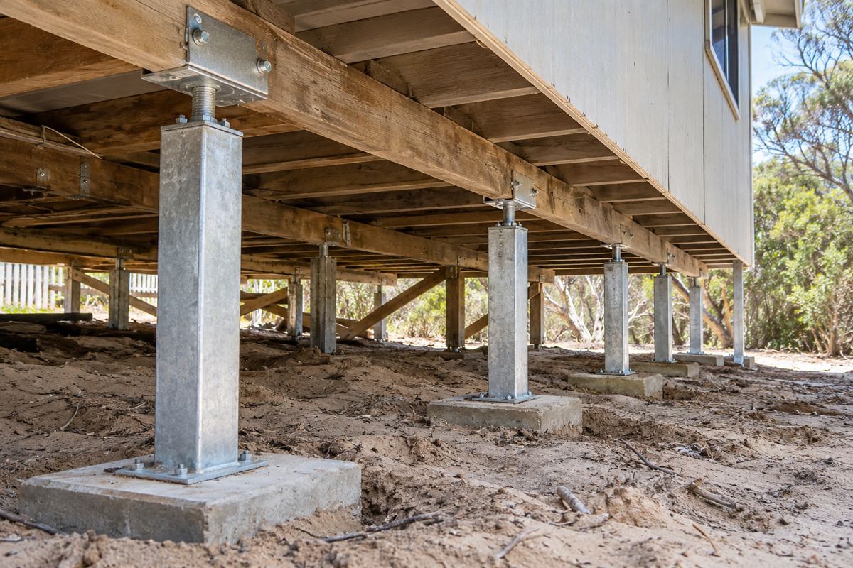
- A house at Rye or St Andrews Beach on the deep Cups sand. Stumps that have sunk unevenly where the sand was disturbed. Steel on a base plate is common here because the house can be relevelled later without digging the sand again. The stump types page weighs it.
- A house at Tootgarook on or near the swamp. The engineer first, because the water table is close to the surface and the peat compresses. The restumper works to the design.
- A post-war cream brick home at Dromana or Capel Sound. If it is brick veneer on stumps, a dropped corner and a stepped crack above it means a careful relevel with small lifts. If it is on a strip footing, it is underpinning on an engineer's design.
- A house on the slope at McCrae or above Dromana. Tall stumps downhill in fill, short stumps uphill near rock. The slope decides the job, and after January 2025 the Shire's overlays decide who is involved.
McCrae, the slope and EMO7
On 14 January 2025 a landslide at McCrae brought down a house on Penny Lane. The Board of Inquiry delivered its final report on 9 September 2025, and in January 2026 the Minister approved EMO7, an interim shire-wide landslide overlay covering about 33,000 properties. Amendment C314morn, approved on 19 October 2026, cut that to about 6,000 properties and set field inspection areas that include McCrae and Rye. The hinterland above, from Arthurs Seat south, was already in EMO1 and EMO2. For a house on the slope, building and earthworks may need a planning permit and a landslide risk assessment by a qualified engineer or geologist, and the Shire waives its fees where EMO7 is the sole trigger and no risk is apparent. The practical position: on a sloping block at McCrae, Dromana or Rye, ask the Shire whether the lot is still in EMO7 after C314morn before anyone quotes, and expect the engineer to be part of the job. The overlays page has the detail.
Heritage, flood and the rest of the rules
Heritage Review Area 2, from Safety Beach to St Andrews Beach including Rosebud, Rye, Tootgarook, McCrae and Capel Sound, was gazetted on 24 October 2019, so some houses here carry a Heritage Overlay. Like-for-like restumping that leaves the outside and the floor level unchanged is arguably maintenance; any visible change can need a planning permit, and the Shire's heritage team gives free pre-application advice at [email protected]. A large percentage of the Shire is designated flood prone, and the swampy pockets between the dunes and the Tootgarook swamp are the obvious candidates; the surveyor tells you whether your lot is flood prone, the property information certificate (regulation 51(2), $53.62 in 2025-26) says so in writing, and building work on it needs report and consent at $329.60 per regulation in 2025-26. The whole Shire is designated subject to termite infestation. Everything else is the same as the rest of the Peninsula: a building permit from a private registered building surveyor, a builder registered with the Building and Plumbing Commission at any job value, a written contract over $10,000 and Home Warranty insurance over $20,000. The permits page has it all.
Getting to a southern Peninsula house
The old holiday streets are narrow, the blocks are often fully grown with tea-tree, and the side paths were not built for a machine. Spoil and old stumps go out by barrow more often than not, and on the Cups sand the barrow sinks. In January the street is full. Spring, with the house empty and the road quiet, is when the crew would rather be there, and for an absent owner it is the easy time to hand a key to the agent and let the job run.
Three things an absent owner can do before the crew arrives make the job easier and sometimes cheaper. Clear the subfloor access, which on a holiday house is often a hatch under a deck or behind a water tank that nobody has opened in years. Pull the garden beds and the tea-tree litter back from the base of the house, because the crew needs to get to the outside stumps and the vents need to breathe afterwards. And find the paperwork, if any exists, from the last time anyone touched the stumps: a permit from a private surveyor, a builder's name, a date. A house that was restumped in the past by a registered builder with a permit is a house the next restumper can quote with confidence, and a house with no paperwork is one that gets the full inspection whatever the vendor or the previous owner said.
The first visit after winter
For a holiday house on the southern Peninsula the signs get noticed on the first long weekend after the wet months. The signs page goes through them, but the short version for sand is this: look for a door that has started to catch, a floor that has developed a slope toward the side where the garden bed is, and through the vents, a stump that leans. On sand the house moves before it rots, so the first sign is often a lean rather than a soft stump, and it can be seen with a torch from outside. A photograph from one visit against the next is a better record than memory, and if the lean is new since autumn, that is the point to ring rather than wait for the next trip down.
What cannot be fixed from the Rosebud sand
A house at Tootgarook cannot be made to sit on firm ground; the peat and the water table are what they are, and the engineer designs around them. A stump on the Cups sand cannot be set on nothing and expected to stay; the base is the job. A slope at McCrae cannot be held still by a stump; if the ground is moving the engineer answers first and the planner second. And nobody can tell you from the street whether a lot is still in EMO7 after C314morn, or whether the stumps under a particular shut-up holiday house have leaned; the Shire answers one, and an hour under the floor answers the other.
Check the current rules before you rely on this
This page describes restumping on the dune sand, swamp and slope of the southern Mornington Peninsula from Safety Beach to St Andrews Beach. It describes the rules in general terms as they stood in October 2026. Standards, forms, thresholds and fines change.
The authoritative sources are Mornington Peninsula Shire open space strategy, housing and occupancy, Victorian Resources Online, Rosebud soil unit, Victorian Resources Online, Cups soil unit, Victorian Resources Online, Tootgarook swamp unit, Mornington Peninsula Shire, McCrae landslide and Mornington Peninsula Shire, municipal heritage review. Where anything here differs from those sources, they are right and we are not.
We are not building surveyors, engineers, planners or lawyers. For what applies to your house, ask a registered building surveyor or ring Mornington Peninsula Shire on 1300 850 600.
Accurate at the time of writing, October 2026. Always check the source before relying on it.